Flooding
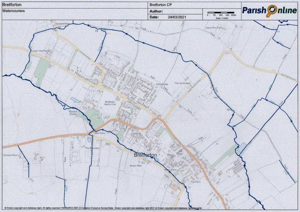
Bretforton is a village in The Vale of Evesham within a few miles of the Cotswold escarpment and as a result rainwater from these hills inevitably passes along the brooks that also drain the land in this area. The attached map shows how the village is surrounded by watercourses and cannot be accessed from the Evesham side without crossing one of these brooks.
The village is largely built on ground above the likely flood levels but some properties are vulnerable and require flood risk management.
When water levels in the brooks breaks over the banks the first area affected is Back Lane. This is aggravated by the culvert at the Bridge Street junction and the one under the B4035 at the entrance to the village which cause the water to back up until Back lane becomes a flooded. This then floods the bottom part of Drinkwater Lane and in particularly bad conditions the main road floods and becomes impassable. If travel in or out of the village is essential in these conditions Station Road to Blackminster is usually available though in extreme floods such as in 2007 this was also not passable.
The Parish Council have obtained a limited supply of filled sandbags which are kept at a farm in the village. At times of significant flooding these will be moved to The Cross for distribution to villagers whose properties need protection from flood water.
The map below shows Bretforton “island”.


